
NOTE: This blog has been updated on 3 January to include the full provisional statistics for December 2022.
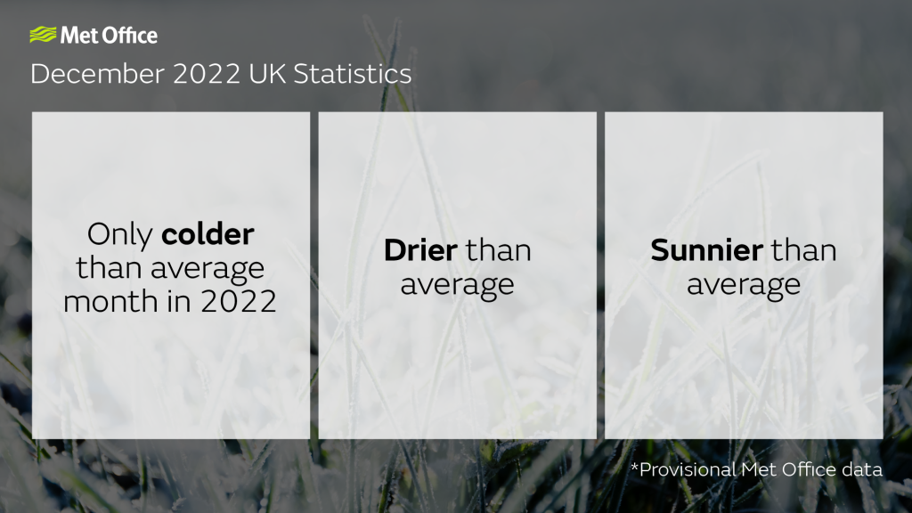
A cold December bucked the trend of 2022 and ended the year as the only month which saw below-average temperatures, according to provisional Met Office figures.
With 2022 provisionally confirmed as the UK’s warmest year on record for the UK December ended a 15-month run of above average temperatures (from September 2021) with an overall cool, dry and sunny month for the UK compared to 1991-2020 long-term averages.
Mostly cold and dry
The first two weeks of December were the coldest start to meteorological winter since 2010, with high pressure and a cool northerly airflow resulting in a prolonged spell of low temperatures with snow and icy conditions at times, albeit with interludes of clear skies.
A weather station at Braemar, Aberdeenshire, recorded the lowest daily maximum temperature of the year, with -9.3°C the highest it reached on 12 December. In the early hours of the following morning, the same station recorded the lowest minimum temperature of the year with –17.3°C.
The cold snap ended with a dramatic change to much milder conditions bringing widespread thaw conditions. Temperatures for the remainder of the month were mostly above average for the time of year, though December overall will still go down as a cool month for the UK with the average mean temperature at 2.9°C, which is 1.3°C cooler than the 1991-2020 average.

Those cool conditions were replicated across the UK with England, Wales, Scotland and Northern Ireland all seeing temperatures around 1.4°C lower than their average for the month, though not cold enough to trouble any records. For comparison, December 2010, the UK’s coldest December on record in a series from 1884, was an exceptional 5.1°C colder than the 1991-2020 average.
Mike Kendon is a climate information scientist working for the National Climate Information Centre in the Met Office. He said: “December’s weather will principally be remembered for the notably cold start to the month, with prolonged low temperatures, hard frosts and snow and ice at times, even to areas further south in the UK.
“This cool weather was principally brought on by an Arctic Maritime airmass, with daytime temperatures struggling to rise above freezing for many in what was one of the most significant spells of low winter temperatures since the exceptional December of 2010.”
Cold weather and climate change
Although the UK will continue to experience a number of cold spells of weather, the frequency, severity and durations of these temperatures has declined as a result of climate change, as can be seen in observational data and as part of a post-event report on early December’s low temperatures.
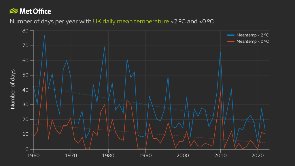
The graph’s blue and red lines show the number of days in each calendar year from 1960 when the UK-wide mean temperature was below 2°C and 0°C respectively, with the hatched lines showing a downward trend.
Mike Kendon added: “Such is the variability of the UK climate, we’ll always experience cold weather. However, what our observed data shows is the decreasing prevalence and severity of these events in a changing climate. Using 30-year climate averaging periods from 1961-1990 and 1991-2020, the number of days where mean temperature for the UK was below 2°C has decreased by a third within this thirty-year period, and the number of days below 0°C has halved. These are dramatic changes.
“The fact that we’ve seen the warmest year on record for the UK in 2022 despite the cold December weather demonstrates how persistently warm the rest of the year was, with every season’s mean temperature sitting in its top 10 on record in a series which goes back to 1884.”
Dry December

Despite late-month rainfall bringing figures up, December remained drier than average for the UK. With milder Atlantic air and associated rain-bearing fronts blocked during the cold spell, there was little precipitation overall across many parts of the UK for the first half of the month.
The UK had 111mm of rain in December, which is 87% of the average.
Northern Ireland has been the driest of the UK regions, with 89.1mm of rain in the month putting it at around three quarters (74%) of what you’d expect in December. England saw 89.3mm (97% of average) and Wales 165.3mm (94% of average).
Sun shines for most
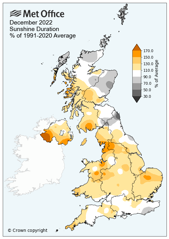
High pressure and clear Arctic air resulted in plentiful clear skies to be found in December, with the exception of northern Scotland, and the UK seeing 16% more sunshine hours than average.
Western areas generally saw more in the way of sunshine, but the vast majority of the UK has had a bright, albeit cold, month of weather. Northern Ireland has seen more than a third more sunshine hours than average (134% of average), Wales 24% more than its average and England 17% more than its average. Scotland will end the month with near-average figures for sunshine.
| Provisional December 2022 | Mean temp (°C) | Sunshine (hours) | Rainfall (mm) | |||
| Actual | Diff from avg (°C) | Actual | % of avg | Actual | % of avg | |
| UK | 2.9 | -1.3 | 49.4 | 116 | 111.0 | 87 |
| England | 3.5 | -1.3 | 59.7 | 117 | 89.3 | 97 |
| Wales | 3.4 | -1.4 | 51.0 | 124 | 165.3 | 94 |
| Scotland | 1.6 | -1.4 | 31.4 | 105 | 136.6 | 79 |
| N Ireland | 3.4 | -1.3 | 51.2 | 134 | 89.1 | 74 |

You must be logged in to post a comment.